

NASSAU, Bahamas — An intensive international search and rescue operation is currently underway in the turquoise waters off the coast of Andros Island, Bahamas, following the tragic reported crash of a private aircraft. The ill-fated flight, which carried four individuals on board, vanished from radar screens on Monday afternoon following erratic flight patterns and amid reports of severe, turbulent weather sweeping across the region.
As local authorities race against the clock, the United States Coast Guard (USCG) has stepped in to provide critical aerial support, deploying specialized long-range surveillance aircraft to comb a vast maritime expanse. With the exact crash site yet to be definitively pinned down and the condition of the four passengers and crew remaining entirely unknown, anxiety and urgency mount as rescue teams battle challenging tropical conditions to locate survivors.
Executive Overview
The incident unfolded on Monday, September 7, 2026, drawing immediate concern from international aviation and maritime authorities. The flight had departed from Great Harbour Cay, a picturesque island in the Berry Islands chain of the Bahamas, and was originally scheduled to touch down at Miami Executive Airport in Florida. However, the routine island-hop to mainland United States took a catastrophic turn over the Bahamian archipelago.
According to preliminary data and official statements, distress signals and tracking anomalies began accumulating shortly after takeoff. Bahamian authorities officially requested international assistance at approximately 2:00 PM local time after losing contact with the aircraft. The Royal Bahamas Defence Force (RBDF) promptly mobilized its local assets and reached out to regional partners, leading to the immediate intervention of the US Coast Guard.
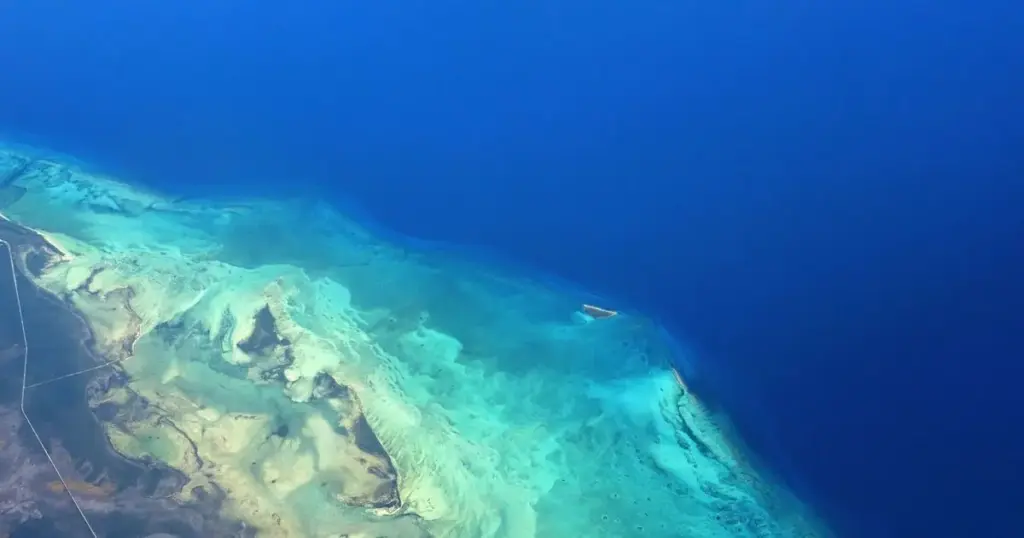
The targeted search zone currently centers approximately 15 miles off the coast of Andros Island—the largest island in the Bahamas archipelago, known for its sprawling wetlands, deep ocean trenches, and notoriously rugged terrain. Weather data from the time of the disappearance indicates that the aircraft may have encountered a severe, unannounced storm system, though investigators have emphasized that it is far too early to attribute the tragedy conclusively to weather conditions.
Detailed Chronology of Events
Pre-Flight and Departure from Great Harbour Cay
The journey began earlier on Monday afternoon at Great Harbour Cay Airport, a common port of entry and departure for private aviators traveling between the outer islands of the Bahamas and the Florida coast. Four individuals boarded the aircraft, anticipating a standard, short-haul international flight across the western Atlantic towards Miami Executive Airport—a journey that typically takes less than two hours under favorable weather conditions.
Erratic Flight Dynamics and Radar Disappearance
Flight tracking metrics retrieved from the aircraft’s transponder paint a troubling picture of the minutes leading up to the disaster. Observers and aviation experts monitoring the flight path noted that the aircraft appeared to execute sudden, inexplicable maneuvers while cruising off the Bahamian coast.
Flight radar logs indicate that the plane inexplicably spun around multiple times over open water before its digital footprint completely flatlined. This sudden cessation of data transmission strongly suggested an abrupt catastrophic event, whether structural failure, loss of control due to environmental factors, or a sudden water impact.
The SOS and International Mobilization
Realizing that the aircraft had missed vital communication milestones and failed to maintain its assigned trajectory, regional air traffic controllers raised the alarm. At approximately 2:00 PM local time, the Royal Bahamas Defence Force formally logged the emergency and initiated local tracking protocols.
Recognizing the expansive nature of the Bahamian maritime frontier and the limitations of local search assets over open water, the RBDF immediately escalated the situation by requesting operational assistance from the United States Coast Guard District Seven command center.
Supporting Context & Metrics: Geography, Weather, and Aviation Hazards
The Geography of Andros Island and Surrounding Waters
To understand the immense scale and difficulty of the ongoing search operation, one must examine the unique geography of Andros Island. Comprising hundreds of small islets and cays connected by shallow mangrove estuaries, Andros is flanked on its eastern side by the Tongue of the Ocean—a dramatic, abyss-like oceanic trench plunging thousands of feet deep.

An aircraft going down 15 miles off the coast of Andros could land in relatively shallow shelf waters or drift rapidly into abyssal depths governed by strong oceanic currents, Gulf Stream influences, and unpredictable tidal movements. This complex bathymetry severely complicates underwater acoustics, sonar tracking, and surface debris drift modeling.
Meteorological Factors: The Shadow of a Wild Storm
Aviation safety analysts reviewing the incident have flagged environmental factors as a primary line of inquiry. Meteorological reports from the afternoon of September 7 confirm that a violent, highly localized storm system was tearing through the central and northwestern Bahamas.
These tropical squalls are notorious for generating sudden microbursts, severe wind shear, zero-visibility rain squalls, and intense electrical activity. While single and twin-engine private aircraft frequently navigate these waters, sudden convective activity can easily overwhelm non-commercial instrumentation or pilot visual references, particularly over featureless ocean expanses where sea and sky visually merge.
Despite these ominous weather reports, investigators have cautioned against premature conclusions. Mechanical malfunctions, pilot incapacitation, fuel starvation, and electrical failures are all standard components of any comprehensive aviation accident investigation and will be thoroughly examined once wreckage is recovered.
Official Statements and International Response
The coordination between Bahamian and United States authorities highlights the robust bilateral safety agreements and mutual aid frameworks that govern the Caribbean and Western Atlantic aviation corridors.
In an official statement released late Monday evening, the United States Coast Guard confirmed its active involvement in the unfolding crisis:
"The @USCG is assisting the @TheRBDF following a report of a downed aircraft with four souls onboard approx 15 mi off Andros Island, Bahamas. A @USCG HC-144 Ocean Sentry aeroplane is supporting the search. The case is ongoing. For more information, contact Bahamian authorities."
The deployment of the HC-144 Ocean Sentry—a twin-turboprop medium-range surveillance aircraft equipped with advanced radar, electro-optical and infrared sensors, and specialized maritime search capabilities—underscores the gravity of the situation. The Ocean Sentry is uniquely suited for scanning vast ocean surfaces, detecting small debris fields, and coordinating on-scene surface vessels.
The Royal Bahamas Defence Force has likewise mobilized fast patrol craft and coastal radar units to scour the shoreline and near-shore waters of Andros Island. However, as of late Monday night, neither agency has been able to confirm the exact resting place of the aircraft, nor have they released any identifying information regarding the four individuals on board, pending family notifications.
Future Outlook and Next Steps
As daylight breaks over the central Bahamas, the search and rescue mission is entering a critical, high-stakes phase. The primary objectives for the multinational task force remain threefold:
- Locate the Debris Field: Specialized surface vessels and aerial units will continue to expand outward from the last known radar coordinates, 15 miles off Andros Island, accounting for wind and current drift vectors.
- Execute Search and Rescue for Survivors: Every effort is being directed toward locating potential survivors who may have egressed the aircraft or are floating in life rafts. Medical evacuation teams remain on standby in Nassau and Florida.
- Launch the Formal Investigation: Once recovery operations transition into recovery and investigation phases, teams from the Bahamas Civil Aviation Department (BCAD), alongside potential assistance from the U.S. National Transportation Safety Board (NTSB), will spearhead the forensic probe to determine the exact sequence of events that led to the tragedy.
The aviation community, families of the passengers, and local residents await further updates from authorities as this developing story continues. Further press briefings from the US Coast Guard and the Royal Bahamas Defence Force are expected as search parameters widen and new data emerges from the field.